Zion National Park in Utah is well known for its multi-layered colorful cliffs. It is less well known for, yet still contains, an abundance of vegetation in the carved valley due to the plentiful flow of water in the Virgin River. One species of tree that is plentiful in the valley area is the Fremont Cottonwood. It was named for John C. Fremont, an American explorer and pathfinder. This species of tree has been used for many thousands of years by the native people of the region for medicinal purposes and for the creation of musical instruments. Fremont Cottonwoods are native to the riparian zones along waterways in the southeast United States. They are deciduous trees whose leaves change colors in the fall and drop off as winter moves in. They have thick trunks of up to five feet in diameter that have a distinctive silver gray color when fully grown. The Wild Images Team chose to compose this image of the Zion Canyon Scenic Drive in the winter time such that the Fremont Cottonwoods were leafless, allowing a nice view of the massive sandstone cliffs that tower over both sides of the road with the very clear blue sky above. The Wild Images Team has captured many other photos in Utah including the competition between cliff colors and clouds in Zion National Park, the intricate designs of the high altitude patterned wall in Zion National Park, distant rain curtains over the colorful cliffs of Bryce Canyon National Park, cloud shadows defining the colorful pinnacles of Bryce Canyon National Park, the scenic view as the full moon rises over Red Canyon, the Goblin Valley State Park thunderstorm and lightning strike over goblins, the impenetrable colorful rim wall of Goblin Valley State Park, the gravity defying balanced rock with snow in Arches National Park, the moment in Arches National Park when a winter storm clears over pinnacles and the La Sal Mountains, the very bright but fleeting rainbow beyond The Hand in Arches National Park, the instance In Arches National Park when lightning strikes near the Three Gossips, the green slopes of Sandy Mountain guarded by red lichen rock sentinels, the wild clouds over the elevated plains of the Grand Staircase-Escalante, and finally in Midway where the five flags of the military fly over Memorial Hill, each of which are available for sale in our store. Blog posts documenting our time in Utah include the road towards the extremely remote Valley of the Gods, an expansive view of the major formations of Zion National Park, the road winding through Fremont cottonwoods in Zion National Park, the road through intricately carved highlands in Zion National Park, the road through red and white rock cliffs in Zion National Park, The Wild Images Team vehicle on a dirt road in Red Canyon, the high altitude scene where a thistle soaks up the brief summer season sunshine, the moment a snake slithers over water plants in Cascade Springs, The Wild Images Team Travel Gnome at the entrance to Cascade Springs, The Wild Images Team Travel Gnome standing proudly in Goblin Valley, The Wild Images Team Travel Gnome at The Brick Oven Restaurant, The Wild Images Team Travel Gnome at the entrance to Bryce Canyon National Park, The Wild Images Team Travel Gnome at an overlook of Bryce Canyon National Park, The Wild Images Team Travel Gnome in front of the rock pinnacles of Bryce Canyon National Park, The Wild Images Team Travel Gnome at the entrance of Zion National Park, and finally The Wild Images Team Travel Gnome in front of the cliffs of Zion National Park.

To see more photos, please visit our store

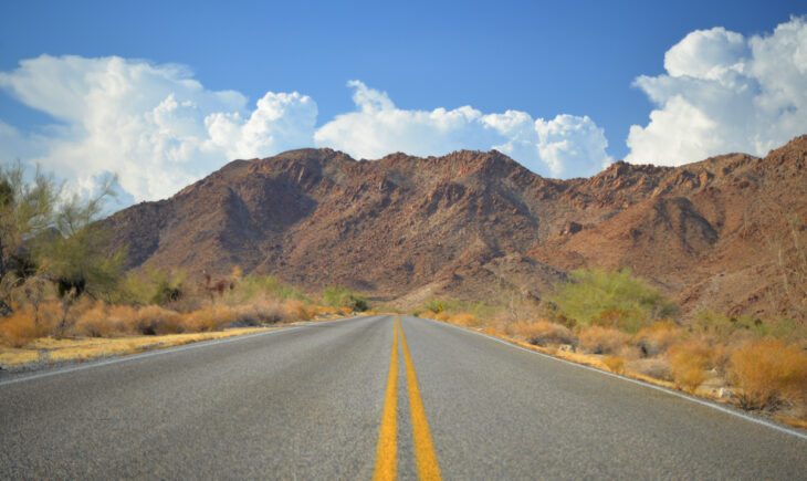
Joshua Tree National Park is located within the desert inland of southeastern California. The land actually encompasses two different desert ecosystems. One of these is the Mojave Desert, the driest desert and landscape in North America, whose region and boundaries are determined by its indicator species: Joshua Trees, which only reside in the Mojave Desert. Connected to the Mojave Desert, but at a lower altitude is the Colorado Desert. It is noted for its abundance of scrub brush. Within Joshua Tree National Park, in the desolation of its southern portion, lies Cottonwood Springs Road. It passes through an opening in the rugged ridges that was carved by meager water flow over the course of millennia and drops rapidly in altitude into the lower Colorado Desert. Here the Wild Images Team captured a photo of Cottonwood Springs road near the passage through the rugged cliffs. This region lies within the Colorado desert, hence the lack of any Joshua trees but plenty of colorful scrub brush and equally colorful desolate ridges. Ahead lies the ascent into the Mojave Desert and its Joshua trees; behind the land descends into the valley where the road meets I-10 at a cloverleaf intersection devoid of any human structures besides the road. The Wild Images Team has captured many other photos from California such as the scene of a blooming thunderstorm over Joshua Tree National Park, the lava flow created streaked ridge in Lassen Volcanic National Park, and the high altitudes where a giant sequoia is larger and redder than others, the steep Hyde Street view of Alcatraz Island and San Francisco Bay, the drastic slope of the abrupt drop off of Taylor Street, the Pine Street colorful terraced houses with background buildings, the historic looking beautiful terraced houses and a Classic VW Beetle, and the Asian inspired intricately ornate Chinatown scene, each of which are available for sale in our store. Blog posts from California have documented the long and winding road climb to the giants of Sequoia National Park, the size comparison of The Wild Images Team Coordinator Christina and the giant tree, the massive view where giant sequoias maintain their diameters over hundreds of feet, an overlook into the Merced River Valley with Liberty Cap, the road heading towards the sheer monolith of El Capitan, the road heading towards desolate ridges of Joshua Tree National Park, the location where the road rises out of Bumpass Hell, a beach dune covered view of the secret underground World War II bunker, the reflective tower of the Marriott Marquis over the Yerba Buena Gardens, the distinctively ornate Asian architecture and decor of Chinatown, the musically inspired melting records with album covers mural, the long strange trip of the Grateful Dead Jerry Garcia mural, the places where steep sidewalks have stairs cut into them, the street where a tree gives a sense of the steepness, the expansive view of Nob Hill from Telegraph Hill and the oppositely directed view from Telegraph Hill to the northeast, the descent in the upper portion of the Filbert Steps, followed by the middle portion of the Filbert Steps with a pose by The Wild Images Team Coordinator on the steps, followed by the lower portion of the Filbert Steps, and at the bottom a view up the Filbert Street steps again with a pose by The Wild Images Team Coordinator below the steps. From our travels in the nearby Oregon and Washington, we have captured photos such as the deep blue hues of swirled clouds and rim peaks reflected in Crater Lake, the Hoh Rainforest green moss covers every possible branch, and the right place at the right time rainbow over the Mt. St. Helens remnants, each of which are available for sale in our store. Blog posts from Oregon and Washington include the sharp looking view through the Lava Cast Forest, the optical illusion of blue waters and white streaks in Crater Lake, the starkly colorful rainbow rises over the devastation of Mt. St. Helens, the moment The Wild Images Team Coordinator Christina is imprisoned by rainforest tree roots, the interesting story of the Port Angeles waterfront Rocktopus Sculpture, and its accompanying bronze plaque of charitable organizations.

To see more photos, please visit our store

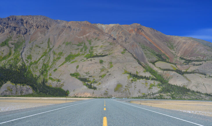
As always, the road of the Alaska Highway passes through one breathtaking scene after another on its course through 1400 miles. This area is certainly no exception. Far west from Whitehorse, the capital of the Yukon Territory, the highway makes its approach to the eternally snowcapped and glaciated peaks of Kluane National Park and Preserve. Mount Martha Black and Mount Archibald both dominate this view towards the south. Beyond this first wall of mountains, and far beyond the reach of any roads, lies a permanent snow cap for the next 100 miles. Within this massive snowcap resides the massif of Mt. Logan, the tallest peak in Canada and the second tallest peak in North America after Mount Denali in Alaska. Further back in the snowcap on the border with Alaska resides the massif of Mount St. Elias, the second tallest peak in Canada and the third tallest in North America after Mount Denali and Mount Logan. Needless to say, all of the surrounding land in this region is high altitude and covered under the permanent snow cap. The Wild Image Team captured this image of the Alaska Highway as it heads toward the front range wall of Kluane National Park and Preserve. The Wild Images Team has captured many photos during our journey up to Alaska through western and northern Canada including colorful canoes standing at the edge of Moraine Lake in Banff National Park, a moment of isolation as a canoe crosses Moraine Lake in Banff National Park, the scene when a grizzly mother is grazing with two cubs, a practically newborn grizzly cub is shorter than the grass, near the Rancheria River where a massive blonde grizzly steps out of the brush, where the remote Liard River wanders through woods and mountains, an action shot when two bison calves are learning to spar, and another action shot as a large bull moose runs through the woods, each of which are available for sale in our store. Blog posts from our journey through Canada document the dark background storm clouds while the grain silos shine in the sunlight of Saskatchewan, the sheer terrain of Cascade Mountain towering over the Bow River valley, the velvet covered antlers of an elk as it passes by in Jasper National Park, the welcome sign declaring you are now entering the world famous Alaska Highway, the very iconic mile 0 signpost found at the start of the Alaska Highway, the desolate road of the Alaska Highway drops down into clouds of the Yukon Territory, the very remote road of the Alaska Highway rounds a mountain within clouds of the Yukon Territory, as the Alaska Highway heads straight towards a giant peak along Kluane Lake, the tall snow-capped peaks along the Alaska Highway west of Whitehorse, the shore lining patterned designs of mudflats from the missing A’ay Chu, as The Wild Images Team Photographer Jeremy Robinson hides in the Signpost Forest, and as The Wild Images Team Coordinator Christina hides in the Signpost Forest. The Wild Images Team has also captured many other images while in Alaska including the terminal moraines of a glacier winding down from the Chugach Mountains, the many splendid colors of the Sheep Mountain chromatic peaks in the Talkeetna Range, as a seal watches over the thick floating ice in Kenai Fjords National Park, as very fast moving seals cut tracks through the ice, as an entertaining seal strikes a pose on Northwestern Lagoon ice, the many miles of Northwestern Glacier reflecting over the turquoise waters, the awe inspiring rumble when a glacier calves of the cliffs in Kenai Fjords National Park, the moment when clouds crown a peak in Kenai Fjords National Park, the long summer days when fireweed enjoys the land of the midnight sun, and as a very playful Dall’s porpoise breaches the ocean surface in Aialik Bay, each of which are available for sale in our store. Blog posts from Alaska document the moment we realized that no bananas on a boat is a very serious rule, as our kayak carrying water taxi Michael A launches from Miller’s Landing, the chaotic scene during a feeding frenzy floating island of seagulls, the majestic bald eagle scanning the coastline from a tree, the expansive view of a colorfully banded rock island reflection, the chaotic jumble of very noticeable blue ice of Northwest Glacier, the reflective view over briefly calm waters of the far northern Pacific Ocean under the Harding Icefield, when The Wild Images Team was photographed at the mouth of a glacier draining tunnel, the intimidating view from the snout of a very large and very steep glacier, and when our Coordinator Christina Orban keeps tradition by kissing the snout of this glacier.

To see more photos, please visit our store

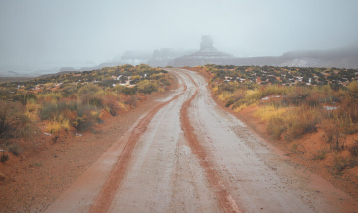
Have you ever been to the Valley of the Gods? If you have never heard of the place, you certainly are not alone. Only a single sign marks its location and it is not found on most maps. However, it is a place that lives up to its name and is well worth the trek. First of all, you have to find yourself in very remote far southeastern Utah, 100 miles south of the much more well known town Moab, also considered to be in southeastern Utah. No, down in actual far southeastern Utah, the only somewhat nearby town, if that is what you call it, is a little place called Mexican Hat. Ten miles north of there is a dirt road with a small sign pointing that somewhere in that direction is a place known as the Valley of the Gods. So what is it? Only a sandstone valley with towering buttes and pinnacles rivaling that of Monument Valley. Yet somehow this location remains virtually unknown and untouched. The dirt road there and back is rough and four wheel drive is required. There is absolutely no facilities anywhere in the vicinity so all food, water, and gas has to be carried in. It is common to see no one there for weeks at a time. But there is plenty of scenery throughout! Here The Wild Images Team took a moment to image our tracks in the muddy road towards the Valley of the Gods during a surprise snow squall there. The Wild Images Team has captured many other photos in Utah including the competition between cliff colors and clouds in Zion National Park, the intricate designs of the high altitude patterned wall in Zion National Park, distant rain curtains over the colorful cliffs of Bryce Canyon National Park, cloud shadows defining the colorful pinnacles of Bryce Canyon National Park, the scenic view as the full moon rises over Red Canyon, the Goblin Valley State Park thunderstorm and lightning strike over goblins, the impenetrable colorful rim wall of Goblin Valley State Park, the gravity defying balanced rock with snow in Arches National Park, the moment in Arches National Park when a winter storm clears over pinnacles and the La Sal Mountains, the very bright but fleeting rainbow beyond The Hand in Arches National Park, the instance In Arches National Park when lightning strikes near the Three Gossips, the green slopes of Sandy Mountain guarded by red lichen rock sentinels, the wild clouds over the elevated plains of the Grand Staircase-Escalante, and finally in Midway where the five flags of the military fly over Memorial Hill, each of which are available for sale in our store. Blog posts documenting our time in Utah include the road towards the extremely remote Valley of the Gods, an expansive view of the major formations of Zion National Park, the road winding through Fremont cottonwoods in Zion National Park, the road through intricately carved highlands in Zion National Park, the road through red and white rock cliffs in Zion National Park, The Wild Images Team vehicle on a dirt road in Red Canyon, the high altitude scene where a thistle soaks up the brief summer season sunshine, the moment a snake slithers over water plants in Cascade Springs, The Wild Images Team Travel Gnome at the entrance to Cascade Springs, The Wild Images Team Travel Gnome standing proudly in Goblin Valley, The Wild Images Team Travel Gnome at The Brick Oven Restaurant, The Wild Images Team Travel Gnome at the entrance to Bryce Canyon National Park, The Wild Images Team Travel Gnome at an overlook of Bryce Canyon National Park, The Wild Images Team Travel Gnome in front of the rock pinnacles of Bryce Canyon National Park, The Wild Images Team Travel Gnome at the entrance of Zion National Park, and finally The Wild Images Team Travel Gnome in front of the cliffs of Zion National Park.

To see more photos, please visit our store

Kluane Lake is the largest lake contained entirely within the borders of the Yukon Territory. The Alaska Highway passes along the southern shores of the lake, allowing some pretty spectacular views of the water. In this region, it actually passes right over the mud flats of the lake as can be seen on both sides of the image. At the time The Wild Images Team passed through the area, the level of the lake was lower such that the mud flats were dried out forming a beach to the water in the distance. In sharp contrast to the very flat landscape here, straight ahead lies Sheep Mountain, a chromatic peak bare from much vegetation. We decided this would be another great location to image the Alaska Highway. Due to the mud flats, one is able to see miles in any direction. While the view looks like a dry landscape found in some the desert areas of the world, just to the left and out of view lies 158 square miles of lake water! As with almost the entire 1400 mile length of the Alaska Highway, this region also has a sense of isolated beauty. While the drive along the highway requires weeks of time each way, it is something one will remember for the rest of their life. The Wild Images Team has captured many photos during our journey up to Alaska through western and northern Canada including colorful canoes standing at the edge of Moraine Lake in Banff National Park, a moment of isolation as a canoe crosses Moraine Lake in Banff National Park, the scene when a grizzly mother is grazing with two cubs, a practically newborn grizzly cub is shorter than the grass, near the Rancheria River where a massive blonde grizzly steps out of the brush, where the remote Liard River wanders through woods and mountains, an action shot when two bison calves are learning to spar, and another action shot as a large bull moose runs through the woods, each of which are available for sale in our store. Blog posts from our journey through Canada document the dark background storm clouds while the grain silos shine in the sunlight of Saskatchewan, the sheer terrain of Cascade Mountain towering over the Bow River valley, the velvet covered antlers of an elk as it passes by in Jasper National Park, the welcome sign declaring you are now entering the world famous Alaska Highway, the very iconic mile 0 signpost found at the start of the Alaska Highway, the desolate road of the Alaska Highway drops down into clouds of the Yukon Territory, the very remote road of the Alaska Highway rounds a mountain within clouds of the Yukon Territory, as the Alaska Highway heads straight towards a giant peak along Kluane Lake, the tall snow-capped peaks along the Alaska Highway west of Whitehorse, the shore lining patterned designs of mudflats from the missing A’ay Chu, as The Wild Images Team Photographer Jeremy Robinson hides in the Signpost Forest, and as The Wild Images Team Coordinator Christina hides in the Signpost Forest. The Wild Images Team has also captured many other images while in Alaska including the terminal moraines of a glacier winding down from the Chugach Mountains, the many splendid colors of the Sheep Mountain chromatic peaks in the Talkeetna Range, as a seal watches over the thick floating ice in Kenai Fjords National Park, as very fast moving seals cut tracks through the ice, as an entertaining seal strikes a pose on Northwestern Lagoon ice, the many miles of Northwestern Glacier reflecting over the turquoise waters, the awe inspiring rumble when a glacier calves of the cliffs in Kenai Fjords National Park, the moment when clouds crown a peak in Kenai Fjords National Park, the long summer days when fireweed enjoys the land of the midnight sun, and as a very playful Dall’s porpoise breaches the ocean surface in Aialik Bay, each of which are available for sale in our store. Blog posts from Alaska document the moment we realized that no bananas on a boat is a very serious rule, as our kayak carrying water taxi Michael A launches from Miller’s Landing, the chaotic scene during a feeding frenzy floating island of seagulls, the majestic bald eagle scanning the coastline from a tree, the expansive view of a colorfully banded rock island reflection, the chaotic jumble of very noticeable blue ice of Northwest Glacier, the reflective view over briefly calm waters of the far northern Pacific Ocean under the Harding Icefield, when The Wild Images Team was photographed at the mouth of a glacier draining tunnel, the intimidating view from the snout of a very large and very steep glacier, and when our Coordinator Christina Orban keeps tradition by kissing the snout of this glacier.

To see more photos, please visit our store

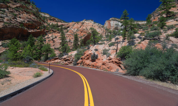
Much of southern Utah is comprised of sandstone. The sandstone was laid down over a period of about 150 millions years, beginning with lowest layer of the Kaibab Formation, followed by the Moenkopi Formation, the Chinle Formation, the Moenave Formation, the Kayenta Formation, the Navajo Sandstone, the Temple Cap Formation, the Carmel Formation, and finally the Dakota Formation representing the highest layer. Each layers has different colors, shapes, and characteristics. Wind and water has carved through the formations and sandstone, carving the region into a rugged and very colorful landscape. Plants and trees, while sparse, have found a way to colonize through the cracks and fissures of the dramatic terrain. The result is a breathtaking landscape. Zion National Park in southwestern Utah is a great example of this. The Wild Images Team has visited here on multiple occasions. During our time there, we wanted to capture how the road turns through the red and white rock cliffs. As it is a desert area, a cloudless bright blue sky topping the image is a standard sight there. Shade is harder to find, and is often provided by rock overhangs such as can be seen left of center in this view. The Wild Images Team has captured many other photos in Utah including the competition between cliff colors and clouds in Zion National Park, the intricate designs of the high altitude patterned wall in Zion National Park, distant rain curtains over the colorful cliffs of Bryce Canyon National Park, cloud shadows defining the colorful pinnacles of Bryce Canyon National Park, the scenic view as the full moon rises over Red Canyon, the Goblin Valley State Park thunderstorm and lightning strike over goblins, the impenetrable colorful rim wall of Goblin Valley State Park, the gravity defying balanced rock with snow in Arches National Park, the moment in Arches National Park when a winter storm clears over pinnacles and the La Sal Mountains, the very bright but fleeting rainbow beyond The Hand in Arches National Park, the instance In Arches National Park when lightning strikes near the Three Gossips, the green slopes of Sandy Mountain guarded by red lichen rock sentinels, the wild clouds over the elevated plains of the Grand Staircase-Escalante, and finally in Midway where the five flags of the military fly over Memorial Hill, each of which are available for sale in our store. Blog posts documenting our time in Utah include the road towards the extremely remote Valley of the Gods, an expansive view of the major formations of Zion National Park, the road winding through Fremont cottonwoods in Zion National Park, the road through intricately carved highlands in Zion National Park, the road through red and white rock cliffs in Zion National Park, The Wild Images Team vehicle on a dirt road in Red Canyon, the high altitude scene where a thistle soaks up the brief summer season sunshine, the moment a snake slithers over water plants in Cascade Springs, The Wild Images Team Travel Gnome at the entrance to Cascade Springs, The Wild Images Team Travel Gnome standing proudly in Goblin Valley, The Wild Images Team Travel Gnome at The Brick Oven Restaurant, The Wild Images Team Travel Gnome at the entrance to Bryce Canyon National Park, The Wild Images Team Travel Gnome at an overlook of Bryce Canyon National Park, The Wild Images Team Travel Gnome in front of the rock pinnacles of Bryce Canyon National Park, The Wild Images Team Travel Gnome at the entrance of Zion National Park, and finally The Wild Images Team Travel Gnome in front of the cliffs of Zion National Park.

To see more photos, please visit our store
Custer State Park is a very large area of land and at 111 square miles is more comparable to a National Park in size. It is situated in the Black Hills of South Dakota. Most of its roadways were built by the Civilian Conservation Corps under the New Deal during the Great Depression of the 1930’s. The Civilian Conservation Corps was a work relief program for unmarried and unemployed men to build the infrastructure of what became many of the nation’s National Parks, National Monuments, National Forests, National Recreation Areas, State Parks, State Forests, and State Recreation Areas. Here in Custer State Park, building the roads would have proved to be a challenge. While the lower altitudes of the park are rolling prairie grasslands, the upper altitudes are dominated by granite hills and spires. It is amazing that roads even exist there. The Wild Images Team captured an example of this difficulty in construction, by showing one section of the road in Custer State Park where it had to be tunneled through two successive rock mounds of solid granite. A close inspection of the image will show where light shines in between the two successive tunnels. These tunnels are quite narrow, allowing only one vehicle at a time, and the other side of the tunnel is often blind so it is best to take it very slow and easy. The Wild Images Team has captured many other images from South Dakota such as the bright flash of a colorful lightning strike over the badlands, the moment that a pronghorn displays its phenomenal physique, and the time that a massive bison bull came meandering past, each of which are available for sale in our store. Blog posts from South Dakota have documented the centuries long carving of the massive Crazy Horse Monument, the very majestic Mount Rushmore and the Avenue of Flags, the expansive view as wild burros walk through the rolling prairies, the ever wary prairie dog stands at attention in the prairie, the amazing location of the granite roadways through Custer State Park, when The Wild Images Team encountered a remote end of trail sign in the middle of nowhere, this close up image of textures in a colorful badlands mound, the interesting time when a flock of turkeys photobombed our image, and The Wild Images Team sunset shadows over Badlands National Park. In neighboring North Dakota, The Wild Images Team has captured images such as the contrast created by the horizontal color bands cross through yellow badlands and the entire herd as a group of wild horses cluster together on a hilltop, each of which are available for sale in our store. Blog posts of North Dakota have documented the herd of bison grazing in the grasslands and the ever changing colorful badland mound that caps a rolling ridge. In neighboring Wyoming, The Wild Images Team has captured images such as the contrast found in the colorful grasslands and background Grand Teton National Park peaks, the varying landscape of Grand Teton National Park rocky peaks and clouds, the large antlers on display as an elk takes a look back in the Caribou-Targhee National Forest, the vertical abruptness as Devils Tower rises above the red rocks and green pines, and the many hues found as the colorful badlands cover over this very remote region, each of which are available for sale in our store. Blog posts from Wyoming have documented as the rugged snowy peaks rise above wildflowers, and as The Wild Images Team Travel Gnome poses for a picture at the Meeteetse “Where Chiefs Meet” welcome sign. In neighboring Montana, The Wild Images Team has captured images such as a group of white mountain goats as they graze the highlands, an expansive view of rocky ridges extending to the horizon, the colorfully massive wall of Hidden Lake, high altitude view of tundra and glacial lakes, a very remote reflective alpine lake covered with rocks, and an ominously approaching heavy downpour over the green foothills, all of which are available for sale in our store. Blog posts from Montana have documented the very deep blue waters of McDonald Creek and the panoramic view of The Wild Images Team at Hidden Lake.

To see more photos, please visit our store

We often wonder what images are conjured up in someone’s mind when they hear about the Alaska Highway. We imagine most will picture a desolate road passing through countless miles of mountains and pine forests. This thought is an accurate description for the actual road. We have never encountered such large tracts of untouched wilderness than along the Alaska Highway as it passes through far northern British Columbia, the Yukon Territory, and into Alaska. The Wild Images Team has only driven along the Alaska Highway twice. Once to Alaska, and then back again. We hope to make it there again soon! One of our goals was to try to capture a sense of the isolated beauty of the road itself. Here the road of the Alaska Highway drops down into the clouds in the Yukon Territory. Thick pine forests line both sides of the road, and stretch to the horizon in all directions. As can be seen by this image, the name highway can be misleading. It is a one lane road over its entire 1400 mile length from Dawson Creek, British Columbia to Delta Junction, Alaska. This is not the only landscape though; the road also passes by tall snow-capped mountains, blue white glaciers, hilly glacial moraines, wide rivers, calm reflecting lakes, low growing tundra, and thick muddy muskegs. The Wild Images Team has captured many photos during our journey up to Alaska through western and northern Canada including colorful canoes standing at the edge of Moraine Lake in Banff National Park, a moment of isolation as a canoe crosses Moraine Lake in Banff National Park, the scene when a grizzly mother is grazing with two cubs, a practically newborn grizzly cub is shorter than the grass, near the Rancheria River where a massive blonde grizzly steps out of the brush, where the remote Liard River wanders through woods and mountains, an action shot when two bison calves are learning to spar, and another action shot as a large bull moose runs through the woods, each of which are available for sale in our store. Blog posts from our journey through Canada document the dark background storm clouds while the grain silos shine in the sunlight of Saskatchewan, the sheer terrain of Cascade Mountain towering over the Bow River valley, the velvet covered antlers of an elk as it passes by in Jasper National Park, the welcome sign declaring you are now entering the world famous Alaska Highway, the very iconic mile 0 signpost found at the start of the Alaska Highway, the desolate road of the Alaska Highway drops down into clouds of the Yukon Territory, the very remote road of the Alaska Highway rounds a mountain within clouds of the Yukon Territory, as the Alaska Highway heads straight towards a giant peak along Kluane Lake, the tall snow-capped peaks along the Alaska Highway west of Whitehorse, the shore lining patterned designs of mudflats from the missing A’ay Chu, as The Wild Images Team Photographer Jeremy Robinson hides in the Signpost Forest, and as The Wild Images Team Coordinator Christina hides in the Signpost Forest. The Wild Images Team has also captured many other images while in Alaska including the terminal moraines of a glacier winding down from the Chugach Mountains, the many splendid colors of the Sheep Mountain chromatic peaks in the Talkeetna Range, as a seal watches over the thick floating ice in Kenai Fjords National Park, as very fast moving seals cut tracks through the ice, as an entertaining seal strikes a pose on Northwestern Lagoon ice, the many miles of Northwestern Glacier reflecting over the turquoise waters, the awe inspiring rumble when a glacier calves of the cliffs in Kenai Fjords National Park, the moment when clouds crown a peak in Kenai Fjords National Park, the long summer days when fireweed enjoys the land of the midnight sun, and as a very playful Dall’s porpoise breaches the ocean surface in Aialik Bay, each of which are available for sale in our store. Blog posts from Alaska document the moment we realized that no bananas on a boat is a very serious rule, as our kayak carrying water taxi Michael A launches from Miller’s Landing, the chaotic scene during a feeding frenzy floating island of seagulls, the majestic bald eagle scanning the coastline from a tree, the expansive view of a colorfully banded rock island reflection, the chaotic jumble of very noticeable blue ice of Northwest Glacier, the reflective view over briefly calm waters of the far northern Pacific Ocean under the Harding Icefield, when The Wild Images Team was photographed at the mouth of a glacier draining tunnel, the intimidating view from the snout of a very large and very steep glacier, and when our Coordinator Christina Orban keeps tradition by kissing the snout of this glacier.

To see more photos, please visit our store
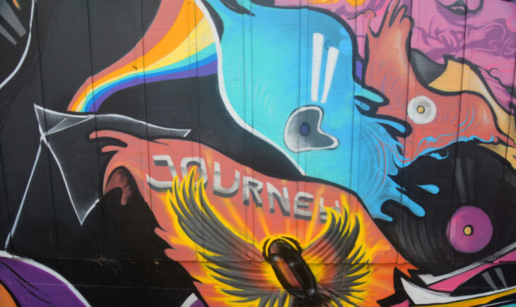
Great art can be found throughout San Francisco, often times in some of the most unexpected places. Like the parking lot of a Walgreen’s Pharmacy. Here can be seen Pink Floyd’s Dark Side of the Moon, Journey’s Greatest Hits, and melting records on the fence mural surrounding the parking lot of the downtown Walgreen’s Pharmacy in San Francisco, California. At first we wondered why such a large and beautiful mural was painted on the fence around the parking lot here. A hint of this comes from the fact that this Walgreen’s sits at the intersection of Bay Street and Columbus Avenue. Longtime residents of San Francisco will be able to tell you that this was once the location of Tower Records, one of the world’s largest retail chains for records, cassette tapes, and compact discs before the MP3 was created and completely killed the market. Their music stores were often massive, allowing a shopper to find just about any album desired. Nowadays this can be done just as easily online. While Tower Records has just recently reopened as an online only store, this mural stands as a reminder of the physical store that used to be found here. The Wild Images Team has captured many other photos from California such as the scene of a blooming thunderstorm over Joshua Tree National Park, the lava flow created streaked ridge in Lassen Volcanic National Park, and the high altitudes where a giant sequoia is larger and redder than others, the steep Hyde Street view of Alcatraz Island and San Francisco Bay, the drastic slope of the abrupt drop off of Taylor Street, the Pine Street colorful terraced houses with background buildings, the historic looking beautiful terraced houses and a Classic VW Beetle, and the Asian inspired intricately ornate Chinatown scene, each of which are available for sale in our store. Blog posts from California have documented the long and winding road climb to the giants of Sequoia National Park, the size comparison of The Wild Images Team Coordinator Christina and the giant tree, the massive view where giant sequoias maintain their diameters over hundreds of feet, an overlook into the Merced River Valley with Liberty Cap, the road heading towards the sheer monolith of El Capitan, the road heading towards desolate ridges of Joshua Tree National Park, the location where the road rises out of Bumpass Hell, a beach dune covered view of the secret underground World War II bunker, the reflective tower of the Marriott Marquis over the Yerba Buena Gardens, the distinctively ornate Asian architecture and decor of Chinatown, the musically inspired melting records with album covers mural, the long strange trip of the Grateful Dead Jerry Garcia mural, the places where steep sidewalks have stairs cut into them, the street where a tree gives a sense of the steepness, the expansive view of Nob Hill from Telegraph Hill and the oppositely directed view from Telegraph Hill to the northeast, the descent in the upper portion of the Filbert Steps, followed by the middle portion of the Filbert Steps with a pose by The Wild Images Team Coordinator on the steps, followed by the lower portion of the Filbert Steps, and at the bottom a view up the Filbert Street steps again with a pose by The Wild Images Team Coordinator below the steps. From our travels in the nearby Oregon and Washington, we have captured photos such as the deep blue hues of swirled clouds and rim peaks reflected in Crater Lake, the Hoh Rainforest green moss covers every possible branch, and the right place at the right time rainbow over the Mt. St. Helens remnants, each of which are available for sale in our store. Blog posts from Oregon and Washington include the sharp looking view through the Lava Cast Forest, the optical illusion of blue waters and white streaks in Crater Lake, the starkly colorful rainbow rises over the devastation of Mt. St. Helens, the moment The Wild Images Team Coordinator Christina is imprisoned by rainforest tree roots, the interesting story of the Port Angeles waterfront Rocktopus Sculpture, and its accompanying bronze plaque of charitable organizations.

To see more photos, please visit our store
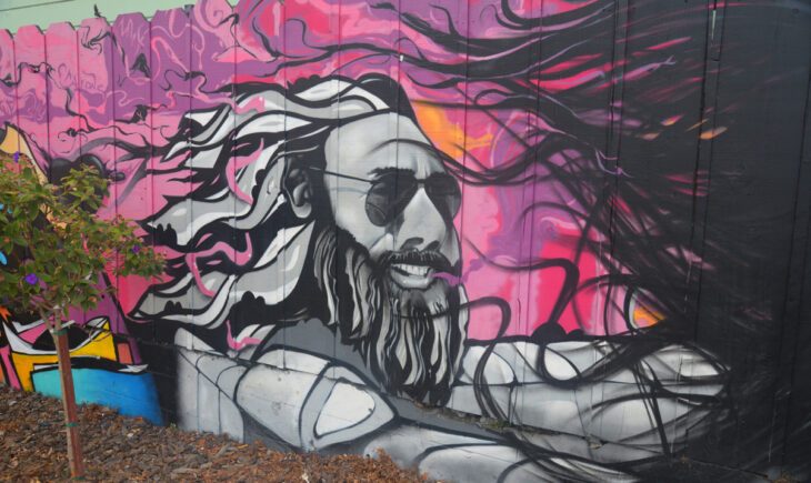
San Francisco is known for many things: the hills, the Bay, Alcatraz Island, cable cars, sourdough bread, music, and art. In exploring the hundreds of blocks of the city by foot, The Wild Images Team encountered many examples of street art, some of which would combine the themes of art and music. This image here is one such example. We found this amazing mural painted on the fence that wraps around the parking lot of the downtown Walgreen’s Pharmacy. This portion is dedicated to Jerry Garcia, the legendary lead guitarist and singer for both the Grateful Dead and the Jerry Garcia Band. Having known his music well, and having seen both bands live on many occasions back before his unfortunate death in 1995, I had to be sure to capture this photo. The Grateful Dead and the Jerry Garcia Band originated right here in San Francisco, and called this area home for their over 30 years of existence, so it is fitting to find a mural dedicated to Jerry Garcia. He was a rock pioneer, and developed what became known as the Bay Area sound which often combined long and intricate musical interludes combined with poetic and meaningful lyrics. He was and will remain a legend forever. The Wild Images Team has captured many other photos from California such as the scene of a blooming thunderstorm over Joshua Tree National Park, the lava flow created streaked ridge in Lassen Volcanic National Park, and the high altitudes where a giant sequoia is larger and redder than others, the steep Hyde Street view of Alcatraz Island and San Francisco Bay, the drastic slope of the abrupt drop off of Taylor Street, the Pine Street colorful terraced houses with background buildings, the historic looking beautiful terraced houses and a Classic VW Beetle, and the Asian inspired intricately ornate Chinatown scene, each of which are available for sale in our store. Blog posts from California have documented the long and winding road climb to the giants of Sequoia National Park, the size comparison of The Wild Images Team Coordinator Christina and the giant tree, the massive view where giant sequoias maintain their diameters over hundreds of feet, an overlook into the Merced River Valley with Liberty Cap, the road heading towards the sheer monolith of El Capitan, the road heading towards desolate ridges of Joshua Tree National Park, the location where the road rises out of Bumpass Hell, a beach dune covered view of the secret underground World War II bunker, the reflective tower of the Marriott Marquis over the Yerba Buena Gardens, the distinctively ornate Asian architecture and decor of Chinatown, the musically inspired melting records with album covers mural, the long strange trip of the Grateful Dead Jerry Garcia mural, the places where steep sidewalks have stairs cut into them, the street where a tree gives a sense of the steepness, the expansive view of Nob Hill from Telegraph Hill and the oppositely directed view from Telegraph Hill to the northeast, the descent in the upper portion of the Filbert Steps, followed by the middle portion of the Filbert Steps with a pose by The Wild Images Team Coordinator on the steps, followed by the lower portion of the Filbert Steps, and at the bottom a view up the Filbert Street steps again with a pose by The Wild Images Team Coordinator below the steps. From our travels in the nearby Oregon and Washington, we have captured photos such as the deep blue hues of swirled clouds and rim peaks reflected in Crater Lake, the Hoh Rainforest green moss covers every possible branch, and the right place at the right time rainbow over the Mt. St. Helens remnants, each of which are available for sale in our store. Blog posts from Oregon and Washington include the sharp looking view through the Lava Cast Forest, the optical illusion of blue waters and white streaks in Crater Lake, the starkly colorful rainbow rises over the devastation of Mt. St. Helens, the moment The Wild Images Team Coordinator Christina is imprisoned by rainforest tree roots, the interesting story of the Port Angeles waterfront Rocktopus Sculpture, and its accompanying bronze plaque of charitable organizations.

To see more photos, please visit our store
Here The Wild Images Team Coordinator, Christina, laughs at the bottom of the Filbert Street Steps on the continuing section of Filbert Street that runs into Levi’s Plaza, named after the famous jeans produced by Levi Strauss & Company and headquartered in this plaza of San Francisco, right next to San Francisco Bay. So why is Christina laughing here? Well for one thing, we have just had a nice adventure coming down off of Telegraph Hill by way of a very large set of stairs named the Filbert Street Steps that was unknown to us until we came across an opening in the shrubbery from which steps descending into the vegetation. Following them led us all the way down here, where Filbert Street continues on once again, but this time as a much flatter version of itself than on the other side of Telegraph Hill where it is one of the steepest streets in the city and its sidewalk is also steps. The day was beautiful and sunny, though not too hot, as San Francisco is famous for its moderate year round temperatures. It is interesting how just across the Bay it will be near 100 degrees and here it will be only 75 degrees. This is enough to make anyone smile. Especially while you are free to wander around the city with no set itinerary. But Christina also laughs easily, and all I have to do is tell a small joke to get her to smile big for a nice image. The Wild Images Team has captured many other photos from California such as the scene of a blooming thunderstorm over Joshua Tree National Park, the lava flow created streaked ridge in Lassen Volcanic National Park, and the high altitudes where a giant sequoia is larger and redder than others, the steep Hyde Street view of Alcatraz Island and San Francisco Bay, the drastic slope of the abrupt drop off of Taylor Street, the Pine Street colorful terraced houses with background buildings, the historic looking beautiful terraced houses and a Classic VW Beetle, and the Asian inspired intricately ornate Chinatown scene, each of which are available for sale in our store. Blog posts from California have documented the long and winding road climb to the giants of Sequoia National Park, the size comparison of The Wild Images Team Coordinator Christina and the giant tree, the massive view where giant sequoias maintain their diameters over hundreds of feet, an overlook into the Merced River Valley with Liberty Cap, the road heading towards the sheer monolith of El Capitan, the road heading towards desolate ridges of Joshua Tree National Park, the location where the road rises out of Bumpass Hell, a beach dune covered view of the secret underground World War II bunker, the reflective tower of the Marriott Marquis over the Yerba Buena Gardens, the distinctively ornate Asian architecture and decor of Chinatown, the musically inspired melting records with album covers mural, the long strange trip of the Grateful Dead Jerry Garcia mural, the places where steep sidewalks have stairs cut into them, the street where a tree gives a sense of the steepness, the expansive view of Nob Hill from Telegraph Hill and the oppositely directed view from Telegraph Hill to the northeast, the descent in the upper portion of the Filbert Steps, followed by the middle portion of the Filbert Steps with a pose by The Wild Images Team Coordinator on the steps, followed by the lower portion of the Filbert Steps, and at the bottom a view up the Filbert Street steps again with a pose by The Wild Images Team Coordinator below the steps. From our travels in the nearby Oregon and Washington, we have captured photos such as the deep blue hues of swirled clouds and rim peaks reflected in Crater Lake, the Hoh Rainforest green moss covers every possible branch, and the right place at the right time rainbow over the Mt. St. Helens remnants, each of which are available for sale in our store. Blog posts from Oregon and Washington include the sharp looking view through the Lava Cast Forest, the optical illusion of blue waters and white streaks in Crater Lake, the starkly colorful rainbow rises over the devastation of Mt. St. Helens, the moment The Wild Images Team Coordinator Christina is imprisoned by rainforest tree roots, the interesting story of the Port Angeles waterfront Rocktopus Sculpture, and its accompanying bronze plaque of charitable organizations.

To see more photos, please visit our store

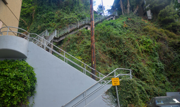
These are the Filbert Street Steps in San Francisco, California. They are the continuation of Filbert Street, where the terrain rises so steeply that no road can be constructed. On their far end, Filbert Street continues on as if it never had this break. This view shows only the very lowest portion of the stairs, which number somewhere around 600 total steps. At the top of the stairs is Telegraph Hill and its famous landmark, the Coit Tower, over 300 feet above this spot and obscured by the thick vegetation around the steps. While in the lower portion here it is mainly ivy clinging to the almost vertical landscape, just above this the vegetation turns into lush gardens full of flowering plants, shrubs, and trees. The flower garden section was inspired by and named after Grace Marchant who lived here from 1949 onward and cleaned up and beautified the area. Another interesting set of residents in the area are the Wild Parrots of Telegraph Hill. These are actual parrots, native to Peru and Ecuador, but somehow a flock of them have established in this area and now number over 200 individuals. It is assumed that they were released pets that began the flock, but no one knows for certain where they came from. The Wild Images Team heard the parrots in the area, they do have a loud squawk, but we did not encounter one for a good image. At least not yet. We hope to return here again soon! The Wild Images Team has captured many other photos from California such as the scene of a blooming thunderstorm over Joshua Tree National Park, the lava flow created streaked ridge in Lassen Volcanic National Park, and the high altitudes where a giant sequoia is larger and redder than others, the steep Hyde Street view of Alcatraz Island and San Francisco Bay, the drastic slope of the abrupt drop off of Taylor Street, the Pine Street colorful terraced houses with background buildings, the historic looking beautiful terraced houses and a Classic VW Beetle, and the Asian inspired intricately ornate Chinatown scene, each of which are available for sale in our store. Blog posts from California have documented the long and winding road climb to the giants of Sequoia National Park, the size comparison of The Wild Images Team Coordinator Christina and the giant tree, the massive view where giant sequoias maintain their diameters over hundreds of feet, an overlook into the Merced River Valley with Liberty Cap, the road heading towards the sheer monolith of El Capitan, the road heading towards desolate ridges of Joshua Tree National Park, the location where the road rises out of Bumpass Hell, a beach dune covered view of the secret underground World War II bunker, the reflective tower of the Marriott Marquis over the Yerba Buena Gardens, the distinctively ornate Asian architecture and decor of Chinatown, the musically inspired melting records with album covers mural, the long strange trip of the Grateful Dead Jerry Garcia mural, the places where steep sidewalks have stairs cut into them, the street where a tree gives a sense of the steepness, the expansive view of Nob Hill from Telegraph Hill and the oppositely directed view from Telegraph Hill to the northeast, the descent in the upper portion of the Filbert Steps, followed by the middle portion of the Filbert Steps with a pose by The Wild Images Team Coordinator on the steps, followed by the lower portion of the Filbert Steps, and at the bottom a view up the Filbert Street steps again with a pose by The Wild Images Team Coordinator below the steps. From our travels in the nearby Oregon and Washington, we have captured photos such as the deep blue hues of swirled clouds and rim peaks reflected in Crater Lake, the Hoh Rainforest green moss covers every possible branch, and the right place at the right time rainbow over the Mt. St. Helens remnants, each of which are available for sale in our store. Blog posts from Oregon and Washington include the sharp looking view through the Lava Cast Forest, the optical illusion of blue waters and white streaks in Crater Lake, the starkly colorful rainbow rises over the devastation of Mt. St. Helens, the moment The Wild Images Team Coordinator Christina is imprisoned by rainforest tree roots, the interesting story of the Port Angeles waterfront Rocktopus Sculpture, and its accompanying bronze plaque of charitable organizations.

To see more photos, please visit our store